Best Lakes in Xinjiang: 8 Alpine and Desert Lakes Compared
The Best Lakes in Xinjiang: A Complete Guide to Eight Alpine and Desert Lakes
Xinjiang has no coastline, yet it has some of the most memorable lakes in inland Asia. Glacial basins under the Altai, a high cold-water lake on the Ili rim, a turquoise mirror beneath Muztagh Ata, the largest inland freshwater lake in China, and a salt pan sitting below sea level all fall inside the same region. That variety is exactly why a “best lakes” list is genuinely useful: these are not eight versions of the same view, and most itineraries can only fit two or three of them. This guide explains what each lake actually offers, what it costs you in driving time, which season it rewards, and how to choose without wasting a day on the wrong one.
The Short Answer: Which Lakes Are Worth the Detour
If you have one lake in your itinerary, make it Kanas Lake in the far north, because its forested valley and the Hemu villages around it justify a multi-day trip on their own. If you are already driving west from Urumqi toward Ili, Sayram Lake is the easiest high-impact addition: the road passes close to the shore, and a single clear morning transforms it. If you are short on time and based in Urumqi, Heavenly Lake is a day trip, though it is also the most visited. If your route goes south to the Pamirs, Karakul Lake is not optional, because the Karakoram Highway runs right past it.
Everything else is a specialist choice. Bosten Lake near Korla is a warm-weather, bird-and-reed landscape rather than an alpine postcard. Ayding Lake near Turpan is a geography curiosity, a dried salt basin at China’s lowest point, not a place to swim or stroll. The wetland at Bayinbuluk is really a grassland reserve with swans and a bending river. Understanding these distinctions before you book a car saves real money and real kilometres.
Why Xinjiang’s Lakes Look So Different From One Another
Three geological stories produce almost all of them. The northern lakes sit in valleys scoured by ancient glaciers and fed by snowmelt off the Altai and Tianshan; they are deep, cold, surrounded by conifer forest, and change colour with sediment and light. The plateau lakes sit on the Pamir and Ili shoulders at high elevation, where sweeping treeless horizons and mountain reflections matter more than forest. The terminal lakes of the Tarim and Turpan basins sit where rivers simply stop, evaporating into salt flats and reed marsh; they are hot, flat, geologically young in appearance, and ecologically fragile.
That split explains the practical advice that follows. Alpine lakes mean winding mountain roads, altitude, and a short season. Basin lakes mean heat, dust, long straight highways, and very little shade. Treating them as interchangeable is the single most common planning error, and it is worth reading a comparison of northern and southern Xinjiang before you commit to a loop.
Kanas Lake: The Northern Classic
Kanas sits in the Altai close to the borders with Kazakhstan, Russia and Mongolia. It is a long, narrow glacial lake in a valley of Siberian larch and birch, with snowy ridges behind it. The water shifts from milky grey-green to a startling blue depending on glacial flour and the angle of the sun, which is why photographs from two different weeks can look like two different lakes. Boat trips run along the lake, a viewpoint above it gives the classic overview, and the nearby villages of Hemu and Baihaba are the reason most travellers stay two or three nights rather than one.
The trade-off is distance. Kanas is a genuine expedition from Urumqi, usually built into a northern loop with the wider Altay region, and access involves a transfer to park shuttle buses. September, when the larch turns gold, is the most photographed window and also the most crowded. June and July bring green slopes and wildflowers with fewer people. If Kanas is your anchor, build the rest of the trip around the Xinjiang itinerary structure rather than trying to tack it onto a southern route.
Sayram Lake: The High Blue Circle Near the Border
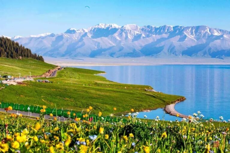
Sayram sits at roughly two thousand metres on the Ili side of the Tianshan, a broad cold lake ringed by low grassland hills. It is often called “the last tear of the Atlantic”, a poetic reference to the moist Atlantic air masses that travel this far east and drop their last rain here. Whether or not you care for the phrase, the effect is real: in late spring and early summer the slopes around the lake can be green and dotted with flowers while the basins to the south are already baking.
The great advantage of Sayram is access. The highway runs near the shoreline, so a traveller driving between Urumqi and Ili can stop for two hours and still get a complete experience, or stay overnight for the sunrise. The town of Bole acts as the practical gateway for fuel, rooms and onward connections. Combine it with the Ili grasslands and the Tangbula corridor and you have a coherent week that never retraces itself. Wind is the main variable; a blown-out afternoon can flatten the reflections completely, so leave a buffer morning.
Heavenly Lake and Tianchi: The Accessible Day Trip
Heavenly Lake, or Tianchi, lies in the Tianshan above Fukang, close enough to Urumqi to work as a day excursion. A narrow alpine lake with the snow-streaked Bogda peak behind it, it delivers the classic mountain-and-water composition in a single frame, with paved paths, visitor shuttles and boat options. Two overlapping guides on this site cover the practical visiting details and the wider Heavenly Lake planning, so check both before you go.
The honest drawback is volume. This is the most heavily visited natural site in the region, and on summer weekends the boardwalks and photo points are busy from mid-morning. Go early, go on a weekday, or accept that you are trading solitude for convenience. It also pairs naturally with a short Urumqi stopover when a longer northern loop is not possible. If you have already seen Kanas, Tianchi can feel small; if you have only three days in Xinjiang, it is exactly the right answer.
Karakul Lake: The Pamir Mirror
Karakul lies beside the Karakoram Highway at high altitude, with Muztagh Ata and Kongur Tagh rising behind it. The name is often glossed as “black lake” in local Turkic languages, a reference to how dark the water turns under cloud. On a still morning it is a near-perfect mirror of the ice peaks; by afternoon the Pamir wind usually arrives and the reflection disappears. Kyrgyz herders graze yaks and sheep along the shore, and simple guesthouses and yurt stays exist for photographers who want the dawn light.
Permits are the key planning point. The lake sits on the approach to Tashkurgan in a border zone, and foreign visitors generally need documentation arranged in advance. Read the dedicated border permit guide and the general permits and insurance brief before booking. The drive itself is covered in the Karakoram Highway guide and the Pamir self-drive route. At this elevation, altitude rather than distance is what limits the day, so plan a slow first night.
Bosten Lake: Reeds, Water and Warm Weather
Near Korla on the north-eastern rim of the Tarim Basin, Bosten is the largest inland freshwater lake in China and a completely different proposition from the alpine lakes. Think broad shallow water, extensive reed beds, wetland birds, fishing boats and a shoreline developed for domestic summer tourism rather than mountain vistas. It is a good family stop in hot weather and a poor choice for someone chasing snow peaks. The Bosten Lake area guide covers the practical layout; anglers should also see the fishing and rivers overview.
Bosten works best as part of a central-southern transect rather than a destination in itself. It combines sensibly with the desert and canyon country to the west, and with the wind-carved yardang landscapes further north. Summer is the season; winter winds make it unrewarding.
Ayding Lake: A Geography Lesson, Not a Beauty Spot
Ayding, in the Turpan depression, is the lowest point in China, lying well below sea level. It is a salt lake that is largely dried out for much of the year, a pale flat basin where heat shimmer does strange things to the horizon. Visitors come for the superlative and for the geological story of a basin that drops far below the ocean while sitting two thousand kilometres inland. There is little shade and essentially no lakeside strolling.
Treat it as a short add-on to a Turpan trip, ideally early in the morning, and keep the heat and health precautions in mind. Summer temperatures here are genuinely extreme. If you want water and green, the grape valleys of Turpan are a better use of the same hours.
Bayinbuluk Swan Lake: Grassland First, Lake Second
Bayinbuluk is a high alpine grassland in the central Tianshan, protected for its swan nesting wetlands and known for the winding “nine bends and eighteen turns” river that spreads across the flat valley at sunset. The lake here is a marshy wetland within that system, not a deep blue basin. Birdwatchers and sunset photographers get the most from it; travellers expecting a shoreline may be puzzled.
It sits on the Dushanzi-Kuqa highway corridor, which makes it a natural mid-route stop on a crossing of the Tianshan. Combine with Nalati grassland for a grassland-focused week. The season is short, and mosquitoes are a real consideration in midsummer.
Matching Lakes to Your Route
Rather than collecting lakes, choose a corridor. A northern loop from Urumqi takes in Sayram, the Ili grasslands and Kanas, and needs eight to twelve days to feel unhurried; the classic seven-day route is a compressed version of it. A southern and Pamir route from Kashgar takes in Karakul and can be extended to the desert lakes; the nine-day Silk Road culture route puts historical sites around the same spine. A short business or transit stay realistically supports only Tianchi and Turpan, with a wider list of places for context.
The mistake to avoid is bolting Karakul onto a northern itinerary, or Kanas onto a Kashgar trip. The distances are large, the roads are slow, and a rushed transfer costs two days. Use the common pitfalls list as a sanity check before paying a deposit on a car and driver.
When to Go, Lake by Lake
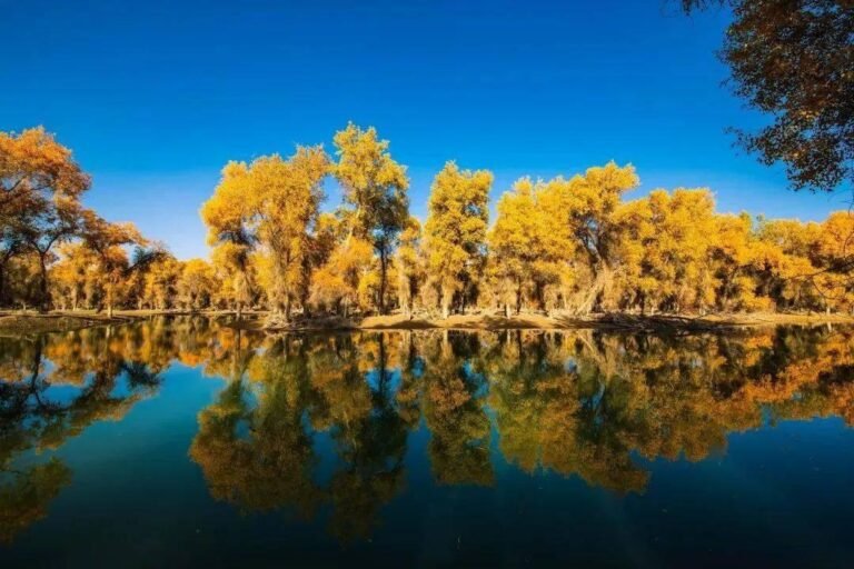
May and June favour Sayram and the Ili side, when the grassland is green and the mountain air is still cool. July and August suit Kanas, Tianchi and Bayinbuluk, though these are also peak domestic holiday weeks with the highest room prices. September is the photographic high point in the Altai and the poplar forests, with crisp light and golden larch; see the month-by-month timing guide before fixing dates. October turns the Pamir cold and can close high passes early, while winter makes most lake roads slow or inaccessible.
Karakul is arguably the most season-tolerant of the mountain lakes because its drama comes from ice peaks rather than foliage, but winter driving on the Karakoram Highway is a serious undertaking. Bosten and Ayding are best avoided in high summer heat and most pleasant in spring or early autumn.
Practical Realities: Altitude, Roads, Permits and Money
Altitude matters at Karakul, Sayram and Bayinbuluk. Arriving from a low basin and immediately climbing to the Pamir is a reliable way to lose a day to headache and fatigue; build a gentle first evening and drink more water than you think you need. Roads in the mountains are paved but slow, with checkpoints, livestock, and occasional seasonal closures, so estimate progress in hours rather than kilometres. Confirm current road and permit conditions locally before departure, because rules near border zones can change without much notice.
Costs split into transport, park tickets and rooms. Park entry and mandatory shuttle buses at the popular northern sites add up quickly for a family, and peak-season rooms near Kanas and Sayram are the single largest variable. Work through the budget guide and the detailed cost breakdown before committing, and read the money-saving brief if you are flexible on dates. Foreign visitors should also check the getting-to-Xinjiang overview for flight and rail gateways, and keep the emergency contacts page saved offline. For current regional travel reporting and official visitor information in English, China Daily’s travel section and the Chinese government’s English portal are useful starting points before you finalise dates.
Photography and Avoiding the Crowds
Almost every lake here is best in the first two hours after sunrise, when the water is calm and the tour buses have not arrived. That single habit improves results more than any equipment. A polarising filter helps with glacial lakes, and a warm layer matters even in summer at high elevation. For site-specific timing, the photography guide is the useful companion, and the dark-sky camping guide explains why the remote lakes are also serious night-sky locations. Always ask before photographing people at close range, particularly at the Pamir shoreline camps.
A Sample Ten-Day Lake-Focused Route
Days one and two: arrive in Urumqi, day trip to Tianchi, stock up and sort paperwork. Days three and four: drive west to Sayram Lake, overnight near the shore, continue through the Ili grasslands. Day five: cross toward the central Tianshan via the Dushanzi-Kuqa corridor with a Bayinbuluk sunset stop. Days six to nine: turn north to the Altay for Kanas and the Hemu valley, allowing at least two full days. Day ten: return to Urumqi. This is a lot of driving; a more humane version drops either Bayinbuluk or the Ili leg. Use the accommodation guide to decide where an overnight is genuinely worth it, and the safety overview for the questions most first-time visitors actually have.
Common Mistakes Worth Avoiding
First, assuming that all lakes are swimmable or even approachable to the water’s edge; many are protected, cold, or fenced. Second, booking a single night at a distant lake after a long drive and expecting both sunset and sunrise. Third, skipping the permit question until the checkpoint. Fourth, planning a summer trip around midday light. Fifth, treating a dried salt basin as a scenic lake. And sixth, trying to see both the far north and the far south in one week. Any of these will cost you more than a slightly shorter itinerary would have.
Frequently Asked Questions
Which lake in Xinjiang is the most beautiful?
Most travellers would say Kanas Lake for its forested Altai valley, though Sayram Lake is the easier detour and Karakul Lake has the most dramatic mountain backdrop. “Best” depends on whether you value forest, open grassland or high peaks.
Can I visit more than one lake on a single trip?
Yes, if you plan by corridor. Sayram, the Ili grasslands and the central Tianshan fit one westbound route; Kanas belongs to a northern loop; Karakul belongs to the Pamir route from Kashgar. Mixing north and south in one short trip wastes days in transit.
Do I need a border permit for any of these lakes?
Karakul Lake and the Tashkurgan approach sit in a border zone where foreign visitors generally need documentation. Most other lakes require only an entrance ticket. Verify current requirements locally before travel, as rules can change.
What is the best month for the lakes?
June to September covers most of them, with September the photographic peak in the Altai and May to June best for green grassland around Sayram. Winter closes or slows several mountain roads.
Are the lakes suitable for families with young children?
Tianchi and Bosten are the easiest, with paved access and facilities. High-altitude sites such as Karakul and Bayinbuluk need more care with cold, sun and altitude, and long transfers are tiring for small children.
Is Ayding Lake worth visiting?
Only as a short geography-focused stop combined with Turpan. It is a largely dried salt basin below sea level with little shade, not a conventional lakeside destination.
Written by Karl Huang – a Xinjiang-based travel writer who has crossed the Tianshan enough times to stop promising himself he will finally catch a calm morning on Sayram, and who still thinks the first sight of Muztagh Ata over Karakul is the best two hours of driving in the region.